 (Click photos to enlarge).
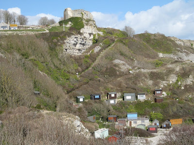
The ruins of St Andrews Church are situated halfway up the cliffside above Church Ope Cove on the eastern coast of the Isle of Portland in Dorset.
 Overlooked by Rufus Castle, St Andrews was originally built between 1150 and 1470 and served as the parish church of Portland until the mid 1700s.
 The church was damaged following a landslip in 1675, but it wasn't until 1756 that the church was finally closed, and when stones were taken away to help build St George's Church at Reforne.
 According to local legend the graves include those of several pirates, although we were unable to make out any of the lettering on the tombstones due to weathering and so couldn't pinpoint quite where their resting places might be. Another story I have heard is that it was French pirates who, along with the landslips, helped destroy the church.
Below we see another picture of Rufus Castle, looking across Church Ope Cove. The cove is now a popular site for fishermen and is home to many beach huts, although it was quite empty when we visited. The beach, which is absolutely strewn with pleasingly round stones and boulders of the grey Portland stone, seems to be quite a tranquil place and it must be a far cry from the days of attacking pirates and the smugglers for which the beach is famous.


